Looking at a map, Toronto and Barcelona are much the same shape.
Cities, sprawling over flat plains, contained by two rivers: one to the east, the other to the west. A hook like protrusion (the Port Lands and Islands in Toronto, Barceloneta in Barcelona) into a large body of water to the south.
 Toronto, and its subway
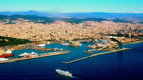
Travelling around Barcelona recently, I couldn’t help but think of home every time I looked at a map.
 Barcelona, and its extensive metro
There are differences of course, given that they are not the same place. Barcelona is contained by a mountain range to its north. The mountain range cups the city and keeps it dense. Toronto has no such boundary and sprawls northward indefinitely. Indeed, a northern boundary had to be artificially created, with Ontario’s Greenbelt.
The on-paper cartographic similarity of Toronto and Barcelona had me day dreaming of a Toronto with more developed transportation infrastructure.
The skeleton of Barcelona’s metro is reminiscent of Toronto’s – a large U line that loops north to central-south and back up again. A line that cuts east to west. There are even small off shoot lines in the periphery a la the Scarborough RT and Sheppard line. Barcelona’s subway system, however, is extensively developed and covers the entire city in ways Toronto could never dream of. Another case of cartographic-deficiency was the coverage of Barcelona’s “Bicing” service vs Toronto’s Bixis. The equivalent to Toronto’s Bixi’s, Barcelona’s “Bicing” city-bikes cover the entire city at a very high frequency.

Toronto’s limited Bixi range

Versus Barcelona’s extensive Bicing network
The comparison is somewhat absurd, but this is what was going through my head every time I consulted a map of Barcelona. I thought, naturally, of home.