Archives for category: psychogeography

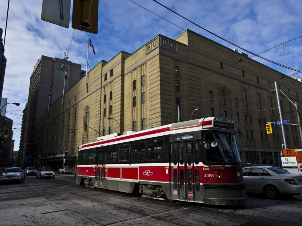
This piece was found in an old yahoo email account. It’s an itemized list of the sents/sounds/sites of Toronto’s old streetcars, written in anticipation of their retirement in 2024

From the outside

The geologic thunder
The ca-clunk ca-clunk
Not being able to see them from a distance
Their green lights fading into traffic lights. Their weak front headlight barely visible as it trundles into oblivion and obsolescence
Stuck behind a turning left car

From the inside
The shuttered click of the back doors, the air releasing as they shut
The squeak of the back motor
The complete silence when that motor turns off
The buzzing sound of the street car moving forward
It’s forward momentum
It’s gentle ascending tone and descending tone when slowing down
The ding of someone pulling the rope to alight
The barely lit stop request sign
The friction of the sliding window
The keep arm in medallion
The availability of the driver, sharing the same space
The release of air as the front doors open
The clink of change in the fare collection box and the drop off them all into the main pile
The thud of shoes on the plastic floor and up and down the stairs
The dinging gong as two streetcars pass each other
The fierce horn at a errant car passing it’s open doors, fiercely defending the street
The click of the back door steps confirming they will open after a slight delay

The too hard to reach pully strung stops

Guest post by Natalie Logan, a documentarian, artist, and aspiring urban geographer

What’s the difference between the woods and a forest? Scale. Then how relevant that the area south of Cedarvale and west of Forest Hill is called “The Woods”?

Most people know this area as Humewood but there is something more poetic with the vagueness of calling it The Woods and dropping the specificness the prefix “Hume” creates. Think of other areas of Toronto that conjure up that kind of feeling, like The Island or The Beaches (though, apparently locals call it The Beach, and technically The Island is really a bunch of islands).

Insiders call their area The Woods because they are familiar with its street names. From the east to west you have Kenwood, Wychwood, Pinewood, Humewood, Cherrywood and from the south to north you have Wellwood, Maplewood, Valewood. According to the Wikipedia article the given boundaries are Bathurst Street on the east, Eglinton Avenue to the north, Arlington Avenue to the west, and St. Clair Avenue to the south.

natdy
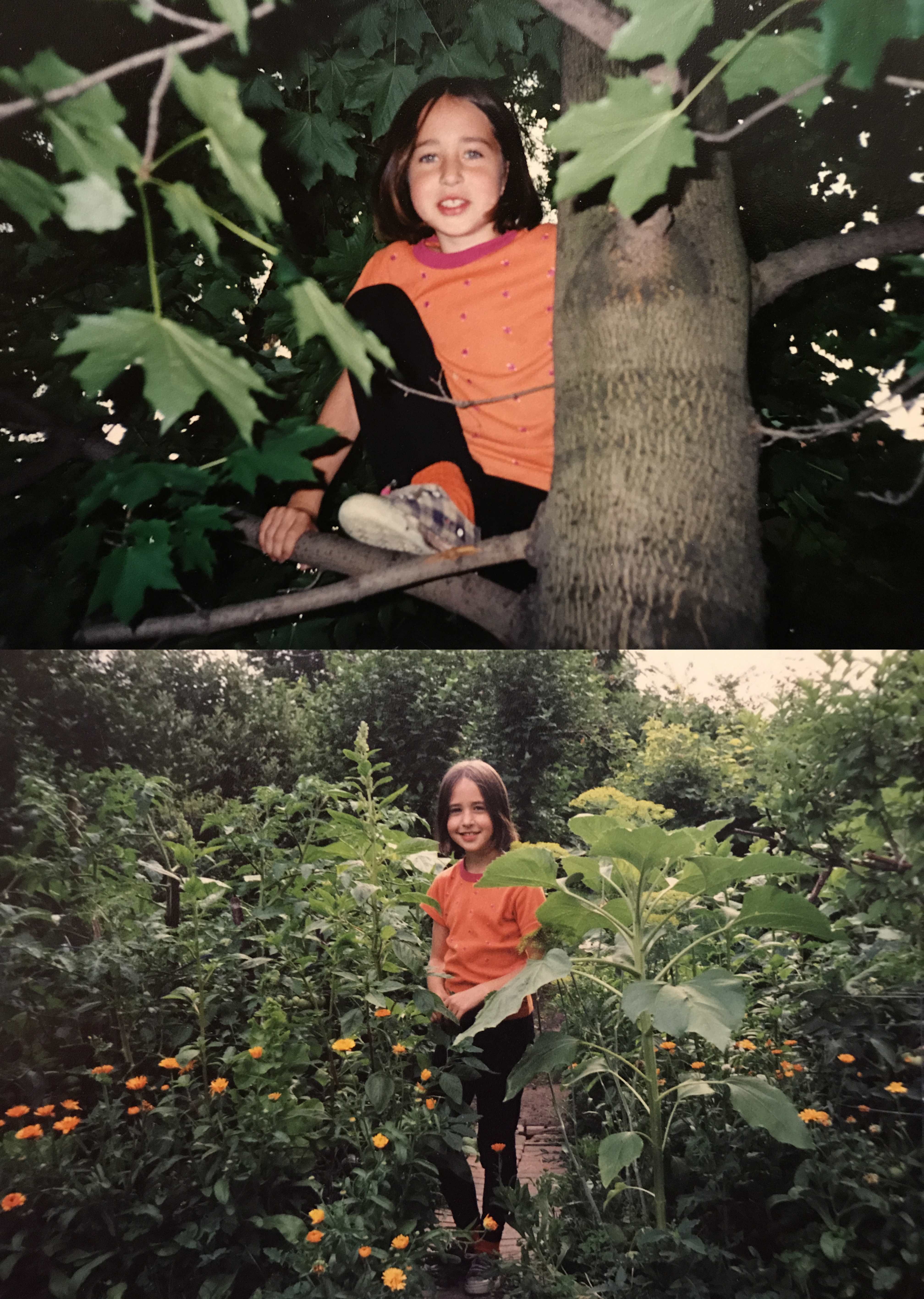
I grew up in the “epicentre” of The Woods. At least a decade of my childhood happened at 24 Pinewood Ave and I currently live off of Wychwood Ave. So I think I have some credibility here. I would expand the boundaries of this area to extend south of St. Clair to the bottom of Davenport because of the Wychwood barns and Wychwood Park, and I would also expand the boundaries as far west as the most recognizable wood named street in the area, Oakwood Avenue. Why leave Oakwood out? Arlington is such a puny side street by comparison and all the other streets that make up the official boundaries are major.

What is interesting about the Wikipedia article on The Woods isn’t just that it challenged my understanding of the boundaries of my neighbourhood, but also the comparison it made between the wealth of the surrounding neighbourhoods. It pits “wealthy Cedarvale in the north” against “the upper middle class Humewood in the south” – they should have said ‘lower upper class’ in the north.

Now that you know, are you going to call this area The Woods? And will you call Forest Hill “The Forest”?

How do insiders refer to your neighbourhood?

Response by Daniel Rotsztain, the Urban Geographer

I love the notion of referring to it as “The Woods” and that being in the same category as “The Island” and “The Beaches”. It elevates this part of town by acknowledging its physical geography, it heightens my expectations for beauty in inland toronto, which is often dismissed as boring, flat, ugly.

You talk about scale: are the woods smaller than a forest? Is the Woods diminutive compared to Forest Hill’s perceived might?

The wikipedia article you referred me to groups together Cedarvale-Humewood so it makes sense that eglinton is the northern boundary… but I agree that the southern boundary doesn’t make sense, and as a natural feature and real “divide’, Davenport makes more sense.

You should try and edit the wiki! That’s the whole point of wikipedia right? Tho, they might not accept your edits because the description of the boundaries of the neighbournood is based on the City of Toronto’s official definition (there are apparently 140 official neighborhoods…) which is a silly exercise because we all have our own personal geographies and definitions of where a neighbourood starts and ends. I lived in Malmo, Sweden and it was much different: each neighborhood had a distinct boundary complete with a sign demarcating where one ended and the other began!

I will definitely start calling this area the Woods, thank you for this insider info. But I don’t think I will call Forest Hill, “The Forest”. It makes more sense to me to call it “The Hills”, linking it to the area west of it, which is all drumlins: egg shaped hills left over from the glaciers

Every day this month, I’ve biked from central Malmö to Alnarp, as small rural community just outside the city and the home of SLU, the university I’m currently doing an exchange at.

The bike ride takes about 45 minutes, and in this short distance, I pass through many distinct landscapes: neighbourhoods within Malmö itself, a highway interchange zone, industrial Ärlov, a bird reserve, and rural fields, all before getting to Alnarp.

Despite being within biking distance, because of all these landscape changes, Alnarp feels very, very far away from Malmö. And phenomenologically, it is. As I’ve explored before in past posts, distance matters less than feeling in determining how “far away” a place is.

Like the short ferry ride between downtown Toronto and Toronto Island, whenever a change in material reality is experienced, places seem very far away, no matter how far the distance.

And on my bike ride from Malmö to Alnarp, I experience many changes in material reality.

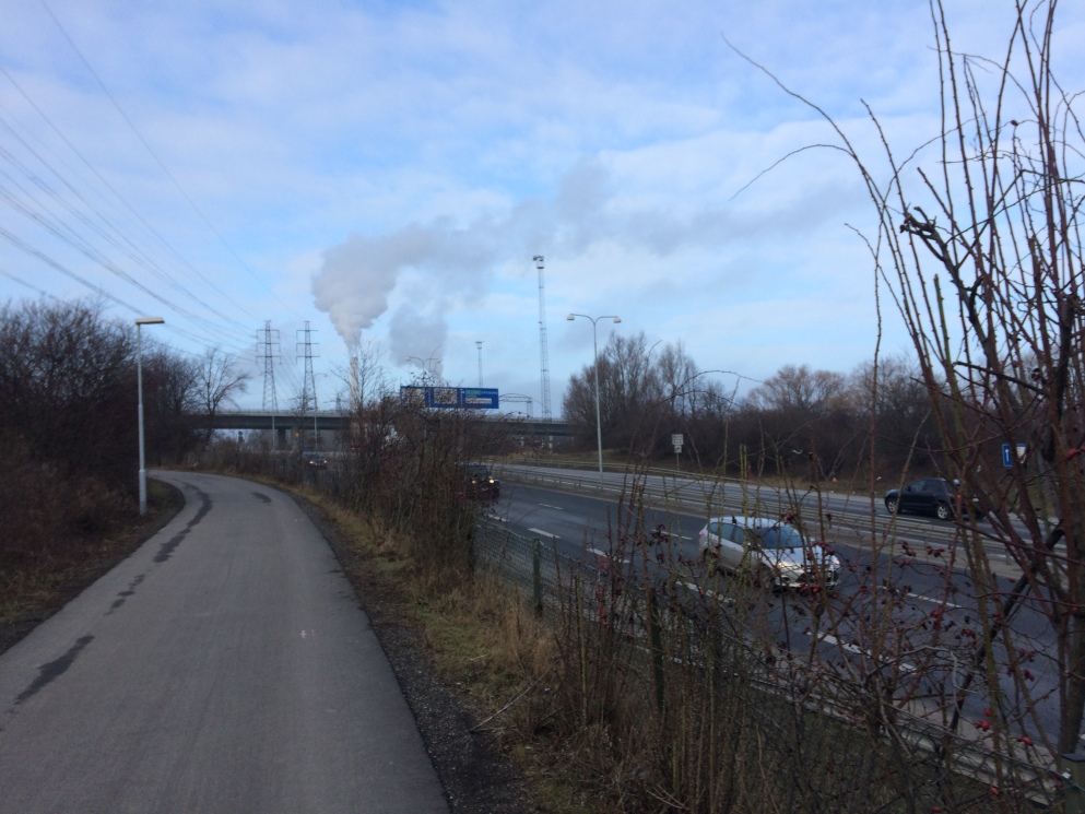
The city drops out, and then I peddle through the land of highway interchanges. The bike path weaves up, down and through bridges and overpasses, floats over the expressway and in between unkempt shrubs. At night, hundred of rabbits scurry between the vegetation, lending this landscape an even more ethereal quality.

IMG_9054.JPG

The land of highway interchanges

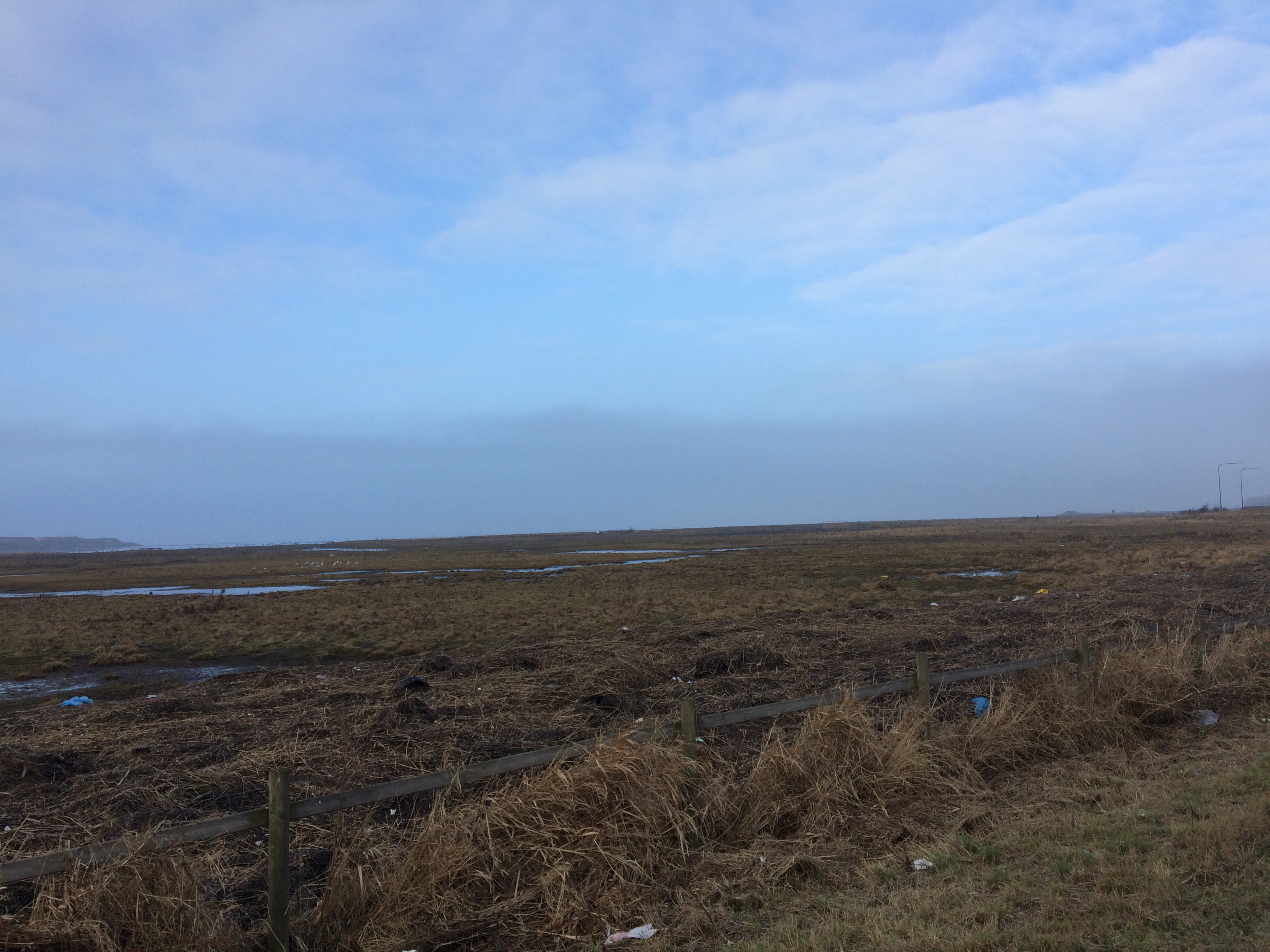
Then, there is the land of the sea – the bike path borders a bird reserve, and the horizon extends infinitely. The smell oscillates from the salty murkiness of the coastline to an almost candy-like scent from the nearby garbage processing plant. The matted grasslands and water channels, the hawks, ducks, geese and crows flying around – this is a wholly distinct material reality where my thoughts expand as my breath shortens to keep up with small inclines.

img_9058

The land of the sea

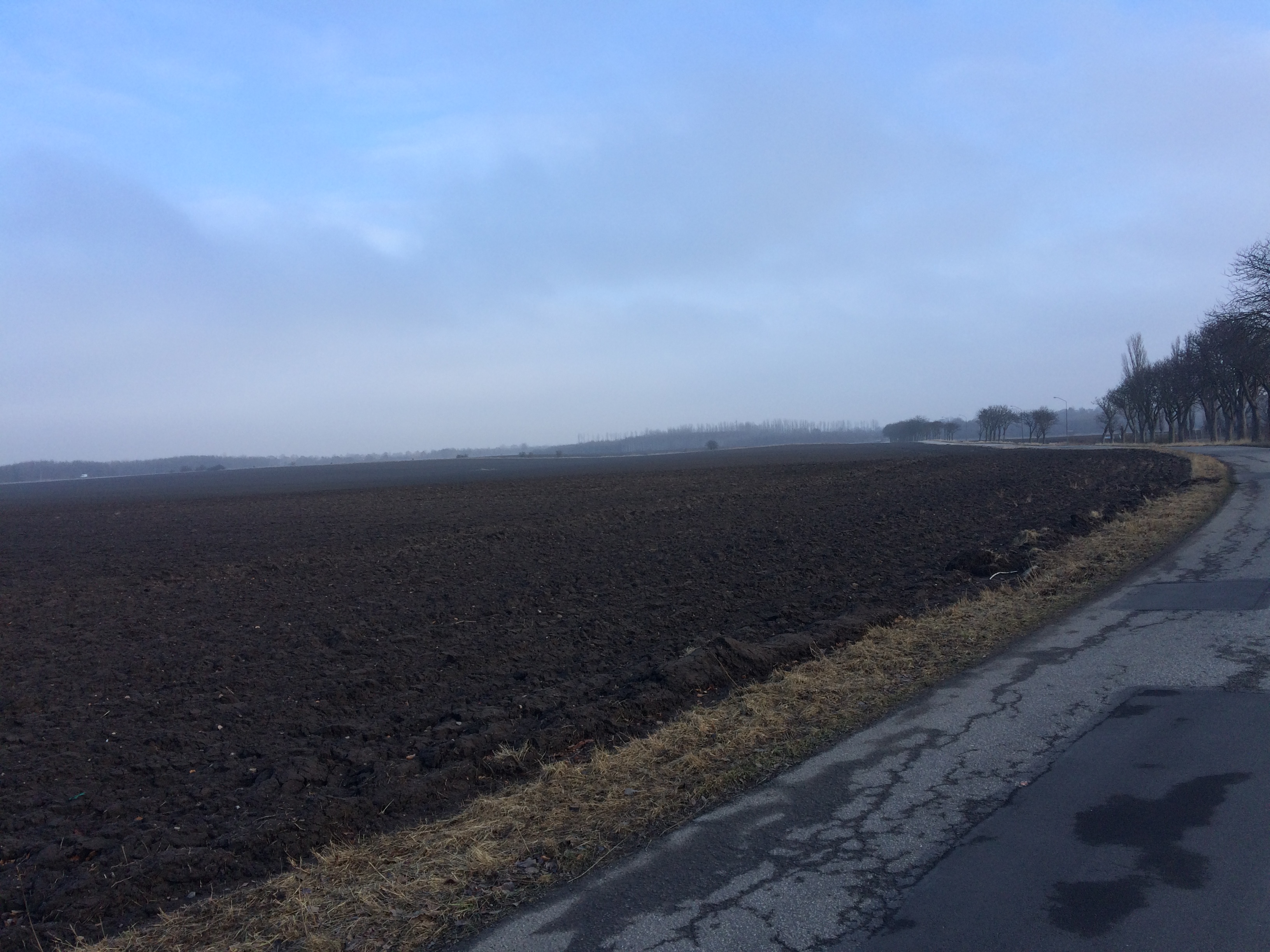
Finally there is the land of the fields.  Naked patches of deep black soil envelop the bike path, and linear bands of trees, bent in the wind add directionality to this change in material reality.

img_9063

The land of the fields

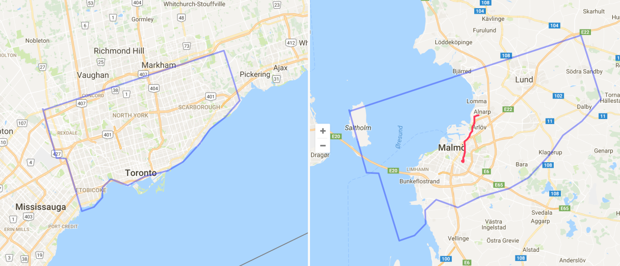
I arrive at Alnarp tired, dazed and feeling distant. Despite this being the distance of roughly the distance of Toronto’s Ferry Terminal to Davenport Rd  and Dufferin (still very much in the city, and a commute I made often last I lived in Toronto), the many changes of material reality make Alnarp very much a distinct place, and my life in Southern Sweden is characterized by inhabiting many places at once, despite occupying the footprint of a tiny portion of the City of Toronto.

Screen Shot 2017-01-27 at 8.26.03 PM copy2.png

Map comparing distances in Toronto and Malmö – the red line represents my bike ride, and the short distance that takes me through so many changes in material reality. 

This post originally appeared on Spacing Toronto

Plan of York Surveyed and Drawn by Lieut. Phillpotts, Royal Engineers. Map courtesy Library and Archives Canada and accessed from http://oldtorontomaps.blogspot.ca/

While gazing over old maps of Toronto, I often long to experience the city before its landscape was so significantly altered. What was it like when the water went right up to Front Street, before infill extended the shoreline by almost a kilometre? How did the Lower Don River feel when it meandered into a vast marshland at its mouth, before it was straightened and channelized?

That’s why I was so excited to visit Long Point last week. A sandy peninsula protruding into Lake Erie, Long Point feels like going back in time to an earlier version of Toronto Island — when it was a wild, sandy and ever-changing spit still connected to the mainland.

img_4626

As Lake Erie shares Lake Ontario’s crumbly shoreline, Long Point is the result of almost the same geologic phenomenon that created Toronto Island — eroded sediment swept by the currents of the lake to create a sandy peninsula and protected bay. The most notable difference is size. While Toronto Island was originally a 9km spit, Long Point is about 40 km.

Unlike Toronto Island after 1858, Long Point is still connected to the mainland. It briefly enjoyed island status after a powerful storm in the 19th century severed a channel through its middle, but was reconnected when sediment washed back to fill the gap. The same would have probably happened in Toronto if there weren’t so much interest in maintaining the Eastern Gap, giving ships easy access to Toronto’s deep harbour and the markets beyond.

Long Point on Lake Erie. Image courtesy of canmaps.com

Beyond its tentative connection to the mainland, Long Point’s form has not been significantly altered by human activity. Whereas Toronto Island was largely fixed by depression era infill projects transforming its ever-changing fingers of sand and marsh into the archipelago of islands we know today, Long Point has maintained its fluid form as a constantly shifting (and hard to map) sand bar.

Compared to the few patches of forest along Toronto Island, Long Point is a vast wilderness. Designated a World Biosphere Reserve by UNESCO, most of the peninsula is conserved explicitly by the Federal Government and Parks Ontario, and inadvertently by the Long Point Company, a private organization that has maintained the spit for hunting purposes since 1866, strictly limiting public access.

Walking along Long Point’s sandy beaches, you don’t even have to squint your eyes to imagine the feeling of Toronto before it was urbanized. An overgrown Carolinian forest hugs its sandy shore, and beyond the bay, where in Toronto a hulking skyline has emerged, there remains open water, marshland and sky. Port Rowan, tucked into the corner where Long Point meets the mainland has a population of about 1000 – the size of the similarly positioned town of York around 1812.

Long Point marshes. Image courtesy of Wikimedia Commons.

Toronto Bay, 1793 by Elizabeth Simcoe

Long Point boasts its own community stretching the first few kilometres of the peninsula, offering a living image of another era of Toronto Island’s history: when it was covered in cottages and fully serviced by hotels, grocery stores, laundromats and restaurants. Like Centre Island before its town centre was demolished by Metro Toronto in the 1950s and 60s, Long Point’s year round population of 450 swells to 5,000 in the summer.

cottage

Many of the cottages that dot the peninsula are reminiscent of the homes that used to cover the Island and those that were saved at Ward’s and Algonquin Islands. Built right up to the beach, their plain geometry bespeaks the simple pleasures of living lakeside, where all you need is a place to rest your head before heading back to the beach. A few grander cottages evoke the summer homes of the wealthy that were built along Toronto Island’s Lakeshore Avenue.

Despite never having been to Long Point before last week, the feeling of familiarity and connection to Toronto Island was uncanny. Of course, Long Point and Toronto Island are distinct places with their own histories, and comparing them requires a a stretch of geographic imagination. However, a visit to the largely preserved landscape at Long Point offers a portal into the past, its equivalent in Toronto having been changed beyond recognition long ago.

Alice Street map

There are, perhaps, no streets more different in Guelph than Alice Street and Woodlawn Road.

On Alice, a jumble of brick houses have been built up to the edge of the street. Before the rise of big box, Alice Street was a hybrid residential-commercial thoroughfare and the heart of the Italian community with general stores and shoe shops in its reconfigured houses. Many of these shops have since turned back into houses, but have been forever distinguished by their past modifications. The effect is an incredibly unique streetscape, like I’ve never seen before, a street of houses with unique DIY renovations, where neighbours hang out on front porches, cars drive slow – the feeling of village and the height of urbanity.

Those aforementioned big box stores – well, they eventually ended up on Woodlawn Road, a street at the northern edge of the city and home to Guelph’s Wal-Mart, Home Depot and various other gigantic corporate retailers.

Woodlawn is a street no one loves but everyone must visit eventually. When I first moved to Guelph, I ended up there countless times, dreading my visits but in need of inexpensive home items only sold there. Woodlawn is the typical non-place at the edge of every city in North America – characterized by the bright signs of fast food restaurants and the complete rejection of walking as a mode of transportation. There are no public gathering spaces on Woodlawn.

It’s easy to love Alice Street. It’s not so easy to love Woodlawn.

So I mapped both, trying to extend my love of place in general to a place that’s hard to love.

And of course, Woodlawn isn’t a non-place, it’s a real place. By choosing to create an illustrated map of it, I’m trying to find its essence beneath the concrete and beyond the international corporate crust that has founds its way there. By mapping Woodlawn, I discovered unique businesses, residential hold-outs, beautiful groves of trees and desire lines criss-crossing its railways.

The map of Woodlawn is an invitation to explore the Woodlawn Road of your city.  Once you get out of your car and walk, it’s easy to find magic beyond the highways.

Woodlawn_Finish2.png


Cities of.png

As my last post explored, Southern Ontario’s physical geography is often ignored, and its landscape is often derided as being flat, monotonous and boring.

Disconnected to the subtle features of the landscape by 400-series superhighways, big box plazas and its relentless grid, its understandable that the infinite beauty of the land beneath the concrete would be, for the most part, forgotten.

Beyond the highways, Southern Ontario’s rich glacial soil has been sculpted into dramatic river valleys, cuestas, waterfalls and the rolling hills of drumlin fields by millennia of water movement.

My map (leading image) is an effort to re-assert the geologic features most prominent in these three very connected cities at the western end of Lake Ontario. Happy exploring!

City of Drumlins

Southern Ontario’s physical geography is often ignored – its landscape is often derided as being flat, monotonous and boring.

But don’t let the gigantic highways and big box plazas fool you – this isn’t so! Southern Ontario’s rich glacial soil has been sculpted into dramatic river valleys, cuestas, and rolling hills by millennia of water movement.

In Guelph, the city is characterized by hills – drumlins, shaped by the glaciers. Many of these drumlins, due to their prominence, have been topped by important buildings and landmarks – like the Church of Our Lady, and Johnston Hall at the University of Guelph.

But many have been neglected by Ontario’s relentless grid, with roads cutting straight up the steep side of a hill, unwavering from the grid’s linearity. In recent years, the places of prominence at the tops of these hills have become just another patch of endless development.

In an effort to re-assert Guelph’s hills/drumlins into the consciousness of its residents, I enlisted the trusty power of an illustrated map to emphasize the prominence of the city’s hills in it’s urban landscape (leading image).

Because I’m new’ish to Guelph, I spoke with many longtime Guelphites to make sure every hill was included and properly named — like neighbourhoods, the names of Guelph’s hills are often contested, but after asking many people, I chose the most common names to include on the map.

The map was first released at 2016’s Kazoo! Fest Print Expo – while several Guelphites knew about the city’s hills, many did not know they were drumlins, while many others had never thought of the city’s topography and appreciated the geographic insight.

As your Urban Geographer, I’m motivated to bring the unique and magical elements of the land beneath the concrete into focus. Stay tuned for more maps!


Newspapers

I love reading the local newspapers of the places I visit.

Every town, city and region is home to at least one hyper-local publication, and often many. Within their pages are articles about the area’s very specific issues, events and politics.

While I’m in these places, I’m enthralled with the content of their local publications. I read the editions from front to back, absorbing the essence of the place, discovering local landmarks, and visiting interesting places I read about.

News places

Sometimes I keep the newspapers as souvenirs of my travels. But a funny thing happens once I leave a place with its newspaper. When I look at it again, long after I’ve left, the newspaper no longer makes sense. Now that I’ve left the sphere of that geographic influence, I can’t wrap my head around learning the details of the articles, the listed events. My mind can’t commit itself to making sense of the text, putting words to reality. Far from its genus loci, the newspaper fades into nonsense.

News non places

The magnetic influence of place has the power to render things comprehensible.

On the other hand, no matter where I am, media from Toronto always makes sense.  I’m always able to interpret the places mentioned, issues, events and politics even if I’m very far away. We bring our home places with us in our heads.


IMG_9421

No, this isn’t a post about the Toronto Dreams Project (though I highly recommend visiting Adam Bunch’s fantastic blog about the lesser known histories embedded in Toronto’s geography).

This is about how Toronto – my home town, the city of my youth, the place that I’ve left and returned to over and over again –  often feels like a dream.

Let me explain –

Every night, I have vivid dreams.

I dream in places. But not fantastical places. Real places, where I’ve visited and lived. When I wake up from the dream, I know where I was, on the surface of the earth, where north was, where the sun set and rose.

I also dream of people – real people, who I’ve met throughout the years. And not just significant people in my life. Those who have played the most minor roles in my past appear as major players in my dreams.

When I sleep, all these place and people mix together so that my dream sequence involves elementary school, high school, summer camp, university dorm rooms and cafeterias, student apartments and street corners, lakes I’ve swam in and cities I’ve visited, all populated with a random assortment of people I’ve known and met and talked to.

When I’m awake and wandering around Toronto, there’s a high chance that I could run into anyone I’ve ever met in on the streets of the city. Someone from every stage of my life, and every place I’ve lived lives in Toronto. (That’s what happens when there are only three major cities in Canada to make a life and one speaks mostly French.)

So, like in my dreams, there’s a possibility in Toronto that anyone I’ve ever met might be on the bus, at the cafe, waiting for the streetcar or subway, biking down the street.

It’s because of this – among other reasons – that for me, Toronto has a dreamy quality.


401 north

All my life in Toronto, the 401 has been north of where I’ve lived.

But now, in Guelph, the 401 is south of where I live.

Yet the 401 has endured as north in my mind. I often find myself looking at maps of Guelph, completely disoriented as to where I am, all because I’ve flipped the map in my mind so that 401 is squarely north, where it’s always been.

I am so surprised that this highway — which I often perceive as the bane of my existence — would play such a prominent role in my understanding of geography.

But it undeniably is.

It’s going to take a long time for me to adjust to the 401 being south. Maybe I never will. The 16 lane wide concrete and metal belt stretching laterally across Southern Ontario and through Toronto will prove hard to shift in my mental landscape.

As I continue to negotiate my identity – Am I from Guelph? Am I from Toronto? Am I spending too much time in Toronto when I should be embracing Guelph? – I’ll take thinking of the 401 as south as a sign that my internal geography has shifted.

tumblr_nemp8gMwUe1t0nycgo3_500

How does that old adage go? Ontario is flat- as flat at can be. 

For those who have explored the province, however, you know this is simply not true.

Look at Toronto on a map and all you see is a seemingly limitless grid of streets, extending indefinitely for kilometres in every direction (except to the south – the sea’s there!). But explore a little, and you’ll soon find steep ravines and the dramatic topography of river valleys spread all throughout the city, hidden beneath the grid.

A Harbourfront photography exhibit debunked the concept of a featureless Toronto topography last summer with No Flat City – a series of photos that explored Toronto’s more steep side.

But even for those in the know, that old notion that Ontario is flat is hard to shake.

Visiting Guelph in the past, the city seemed like another instance of even-grounded Ontario – but for a few rolling hills it felt like a limitless plane on which agricultural, suburban and urban development could be built indefinitely.

But as I get to know Guelph – drive down its streets, bike up its hills and walk along its rivers and alleys – I am learning the subtle topography of this place. As I push into Guelph’s topography, those subtle inclines become more dramatic – I understand where the highest bluffs and lowest river valleys are – I know where to go for the best views. (So far, that’s on College street just west of the University of Guelph, where the city looks like it’s emerging from an lush forest).

Whenever I look at a physical topographical map, I’m always surprised to see how unvaried the landscape seems from a large scale. I run my hands across the raised surfaces — even mountains appear like small bumps rising only slightly from the landscape.

There’s a subjective experience of topography that makes the hills appear beneath your fingers. Every huff of breath, every extra push in the pedal, every time your ears pop in the car, you are pushing into topography and making the ups and downs of landscape real and legible.

This post first appeared on the Koffler Gallery’s K-Blog, and was collaboratively written by myself, Mary Anderson, Mariah Hamilton and Jessica Dargo-Caplan. All photos by Mary Anderson. 

On Sunday, May 3, 2015, the Koffler Gallery organized its first Jane’s Walk, which explored the Urban Legends of our West Queen West neighbourhood. Our walk was created and led by Urban Geographer and artist, Daniel Rotsztain.

Inspired by the Koffler Gallery exhibition Erratics, (which explores the tensions between memory and fiction), Daniel introduced the walk by posing the question, “does Toronto have amnesia?”

Image1_675

Image3_675

Daniel led our group on a 2-hour walk through Toronto’s West Queen West neighbourhood, attempting to reassemble the neighbourhood’s memory by uncovering its histories, urban legends, and everything in between.

Image4_675

“What happens to a city’s notion of history when it has amnesia? A funny thing happens where the lines blur between fact and fiction. Without a strong historical tradition, urban legends emerge to fill the gaps and pass for that history. Strange historical blips, and anecdotal evidence emerge as what we remember. There are zones with strong historical memory, and others that people pass without a thought. But can’t we say that about all history? What distinguishes an urban legend – a story passed down through an oral tradition, from the random facts that become enshrined as historical evidence?” – Daniel Rotsztain

Image5_675

Our second stop was in front of The Lakeview Diner, where Daniel told us about the legend of the Lake Ontario Sea Serpent, which was named Gaasynedietha by First Nations people.

Image6_675

Our third stop was at Crawford and Dundas – where we explored the mystery of the green posts. Are they some sort of escape exits? Super Mario pipe replicas? Or are they berating tubes for a community of mole people, dwelling beneath Toronto? As Daniel explored these urban legends, he pointed out that the posts are actually ventilation stacks for a complex sewer system known as the Mid-Toronto Interceptor.

Image7_675

Our fourth stop was on Crawford Street – the buried bridges of Garrison Creek. Here, we explored the the legends of Garrison Creek, Toronto’s most famous lost waterway, as well as some lesser known facts about the creek including lost visions for its future.

Did you know that you used to be able to navigate the creek by boat, well north of Bloor, and that it was 10 metres wide and 20 metres deep at its largest?

Image8_675

Our next stop led us through the paths of Trinity Bellwoods to the park’s valley, or what it has become affectionately known as the Dog Bowl.

Image9_675

We often hear that Garrison Creek is “dead” or “lost” – but is it really? Here Daniel described some of the legends of Toronto’s zombie rivers, rising from the dead. These lost and buried rivers make themselves known quite frequently – re-emerging during rainstorms and leaching ancient dump chemicals into waterways. “The creek is not dead, but was buried alive!”

Image14_675

We continued our walk through the rest of Trinity Bellwoods to stop at our next location, the Trinity Gates. Just as the topography leave clues of lost rivers, Trinity Bellwoods’ gates are a clue of lost campuses. Here we explored the legends surrounding Trinity College, and other architectural fragments.

Image10_675

On CAMH’s grounds we recalled the history of the provincial mental health institution, and how the original 1850 buildings were demolished, leaving only its walls. Here we also discussed the legend of failed architecture, and the truth of failed governance.

Image11_675

Our next stop was at Dovercourt and Sudbury Streets where we remembered 48 Abell Street – an important building for West Queen West’s early art scene. It has since been demolished and replaced by condos.

Image12_675

We concluded our walk at Queen and Dovercourt, in front of West Queen West’s iconic, You’ve Changed mural. Daniel invited Carrie Lester to lead this portion of the walk. Carrie is a Haudenosaunee storyteller who told us about the meaning of Toronto, the myths and history of the land on which the modern city is built.

Image13_675

The walk brought to light many kinds of urban legends and histories. Stories were told as we attempted to untangle fact from fiction, and knit together our collective histories.